Mapping Data Software: Turning Complex Location Intelligence into Action
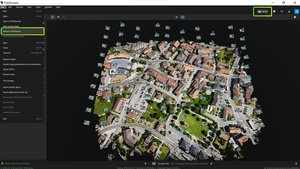
Modern organizations rely on accurate geographic insights to make informed decisions, and that is where mapping data software plays a critical role. Businesses, municipalities, and infrastructure teams use these systems to visualize terrain, analyze spatial relationships, and organize massive amounts of geographic information in a clear and usable format. From urban planning to environmental monitoring, digital mapping tools help transform raw coordinates into actionable intelligence.